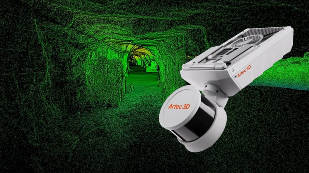
Artec Jet: High-Precision SLAM LiDAR Scanner for Any Environment
Artec Jet is a high-speed mobile LiDAR mapping system combining SLAM positioning with AI-powered autonomy. It captures sites, infrastructure, and industrial facilities…
Contents
From Physical Sites to Digital Twins in Minutes
Artec Jet is a high-speed mobile LiDAR mapping system combining SLAM positioning with AI-powered autonomy. It lets you digitize sites, infrastructure, and industrial facilities even in areas without a GPS signal—in minutes rather than hours—while maintaining survey-grade accuracy.
Scan handheld or mount the device on a backpack, robot, vehicle, or drone. Artec Jet offers multiple deployment options in one compact, lightweight unit. Choose the mode that best suits your task, from outdoor topographic surveying to underground mapping, and keep your team safe by avoiding dangerous or hard-to-reach areas.
Artec Jet captures high-accuracy data for mining, construction, defense, infrastructure projects, and public safety. The data are ideal for creating digital twins, as-built documentation, volume measurements, clash detection, and inspections.
Digitize Any Environment Without Exceptions
Capture accurate data anywhere, in any conditions, without relying on external infrastructure such as GPS navigation or mapping. The system handles:
- Underground sites
Urban environments
Outdoor structures
Indoor spaces
Industrial facilities
From heavy machinery and vertical shafts to factories, open sites, and road networks, Artec Jet scales easily with the size and complexity of your project. Access difficult or dangerous locations and scan critical assets using a single device built for demanding conditions.
Confidence in Every Scan
Artec Jet's features, accessories, and advanced software work together to help you get the job done right the first time. This increases productivity and efficiency without adding risk, cost, or delays to your workflows.
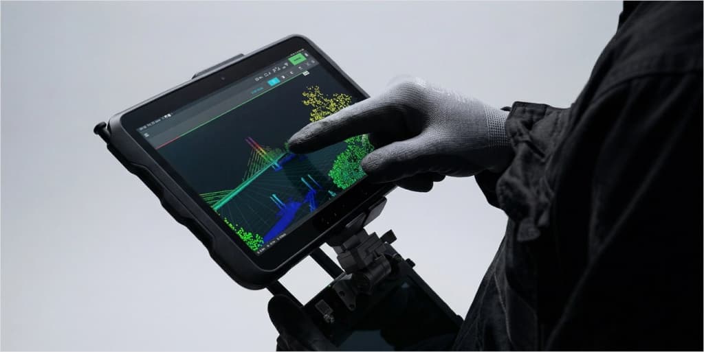
- Real-time feedback: Artec Jet streams a point cloud preview to its companion app while scanning. You can immediately confirm that all data have been captured and that rescanning will not be needed.
- 360° scene capture: With a 360° × 290° field of view, Artec Jet creates dense point clouds in a single pass without blind spots, providing full coverage.
- Color capture: Combine LiDAR data with images from a supported camera to create vivid, realistic 3D models with recognizable landmarks.
- GNSS georeferencing: Use satellite positioning with RTK accessories to increase global accuracy and reduce reliance on control points.
- Easy to learn: One-button scanning and plug-and-play operation. No specialized training is required; start capturing high-quality data immediately.
- On-site data validation: Review results directly at the site to confirm that each session's data are complete and usable before leaving.
One portable scanner, seven ways to deploy. Reliable SLAM algorithms let Artec Jet deliver consistent results across seven deployment modes. Choose the approach that best fits your current project and be ready for future challenges. One device, one workflow, one investment.
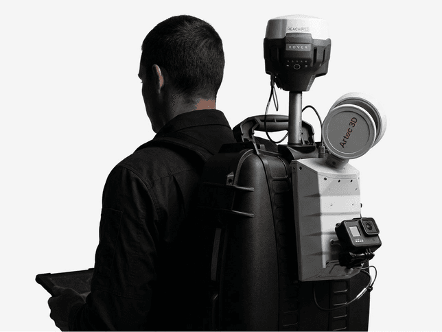
Backpack
Keep your hands free during lengthy topographic surveys. Use RTK or ground control points (GCP) for surface georeferencing, then transition smoothly into GPS-denied areas within the same session.
Handheld
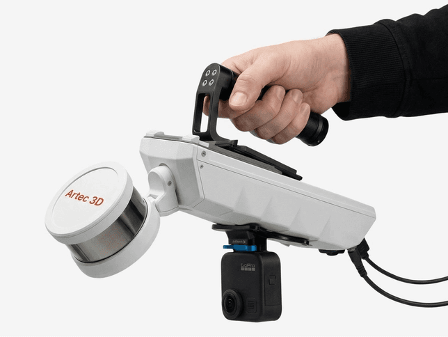
With a handheld SLAM LiDAR scanner, you can easily walk through and scan any space. Weighing just 1.57 kg, Jet is convenient to carry through buildings, industrial facilities, and confined interiors.
Drone
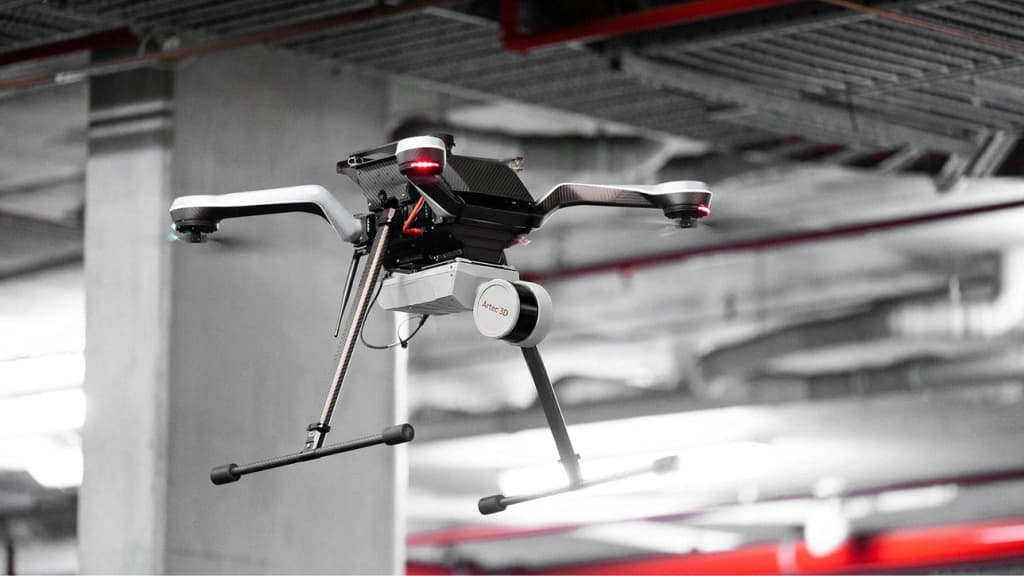
Reach dangerous, elevated, or out-of-sight locations with an aerial mapping solution. The AI-powered autonomous system avoids collisions and explores safely—even in complete darkness.
Robot
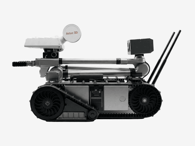
Mount the scanner on a robotic platform to map confined or hazardous areas without exposing personnel to risk.
Telescopic pole
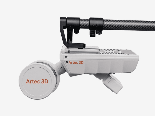
Reach ceiling voids, narrow spaces, and infrastructure details up close. The pole extends Artec Jet's reach without a drone, increasing point density in hard-to-access areas.
Protective cage
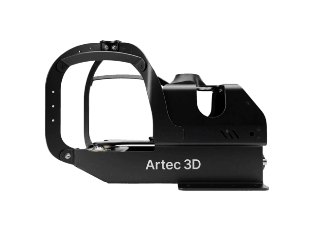
Lower the scanner into vertical shafts, voids, and enclosed spaces. The stainless steel frame protects against impacts and slides smoothly to prevent the device from getting stuck.
Vehicle mount
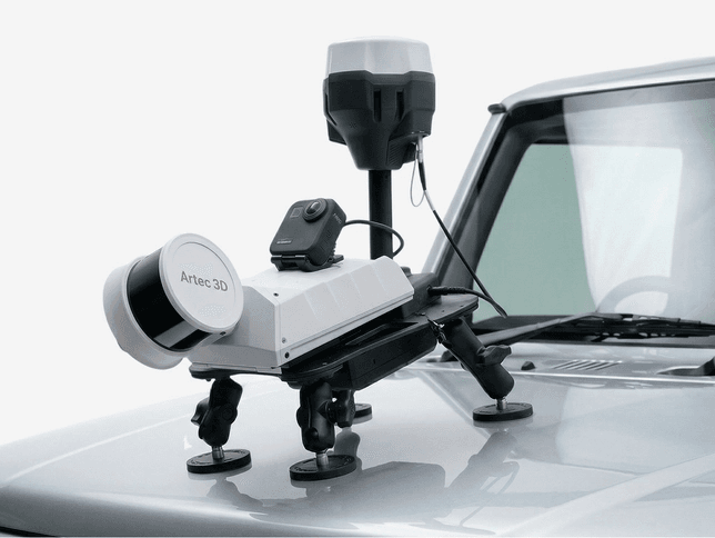
Capture roads, tunnels, large sites, and extended infrastructure at driving speed. RTK integration provides automatic georeferencing and drift correction over long distances.
Autonomous Mapping Beyond Human Reach
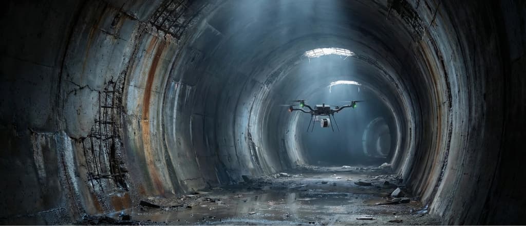
An AI-powered autonomy engine lets drones access unreachable locations, collect data where GPS mapping is impossible, and keep your team safe—all without a pilot. Simply define waypoints, and the drone flies autonomously while avoiding obstacles.
- Collision avoidance: LiDAR creates a safety zone around the drone and detects obstacles as small as a 2 mm wire. This enables operation in confined spaces, protecting equipment while data collection continues without interruption.
- Beyond visual line of sight
- Direct the drone autonomously beyond visual range. Using advanced route planning and proximity sensors, it explores unknown environments and captures data in places operators cannot physically reach.
- Safe return to base
- If the battery runs low or conditions deteriorate, Artec Jet automatically returns to base along a safe, previously mapped route. No drone is lost, and no data are missed.
Artec Jet is a versatile tool for creating accurate digital twins, producing as-built documentation, and safely inspecting assets remotely. It is used for topographic surveys, calculating stockpile volumes, monitoring deformation with millimeter accuracy, and regularly tracking construction progress and infrastructure conditions.
Jet is an advanced solution that digitizes almost any physical environment quickly and accurately, reducing time and resource requirements from design through operation.
Want to learn more about Artec Jet and how it can address your project's needs?
CAD.kz provides end-to-end services: we supply equipment, integrate it into your workflows, train your staff, and provide expert support.
Tel.: 8 (7172) 57-70-75, 57-80-28
- Mobile
- 8 (701) 550-18-93 (+Whatsapp)
- office@cad.kz