
Converting Point Clouds into 3D Revit Models
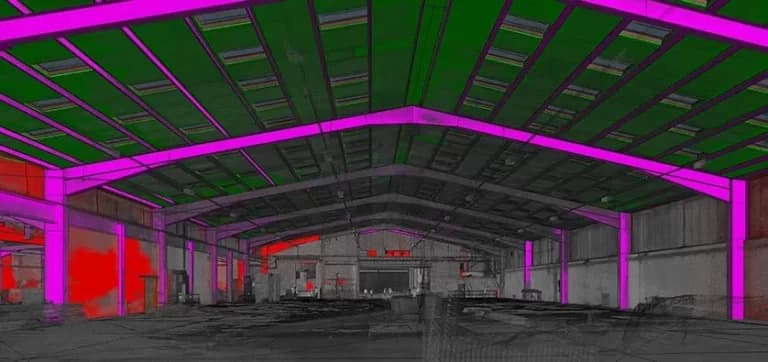
Point clouds capture fine details of historic buildings, allowing structures and architecture to be reconstructed even without documentation. Recording the current state and creating…
You can register here.
Point cloud modeling in BIM
Detailed point clouds for 3D models, combined with appropriate Revit workflows, can save time and money and improve return on investment.
Why is this needed, and where is it used?
One example is the major renovation or restoration of a large project. First, the entire site is scanned to create a point cloud; the data is then cleaned (learn more in our online webinar) and converted into a BIM model.
Using 3D measurements and survey images, Revit is one of the easiest ways to build a BIM model from scan data. The result is a digitized version of the building with 3D visualization, providing a better understanding before restoration or major repairs begin, including:
- Material quantities
- Labor costs
- Accurate renovation timelines
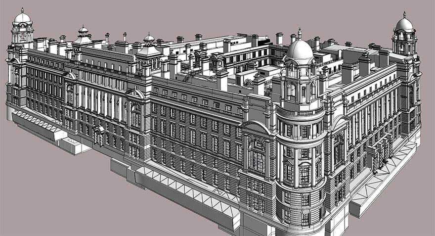
How to efficiently convert a point cloud into a Revit 3D model
Using a practical coordinate system anchored by a base point improves the accuracy and visualization of a 3D model.
Coordination issues must be resolved. This is done by assigning equivalent coordinates to the scans to establish the point cloud's orientation and new position. Setting a base point using shared coordinates and moving it closer to the project coordinates can make it easier to work in the original coordinate system.
A practical coordinate system can help display point clouds accurately in Revit. Advanced processes and tools can be used to visualize point clouds quickly, extract measurements, and obtain coordinates.
Removing unwanted information from scanned data improves 3D model performance.
Three-dimensional point clouds collected by laser scanners can contain unwanted data about surrounding objects. Removing this noise during geometry processing helps identify the actual scanned areas. Depending on the source, internal and external noise or other unnecessary data can be cleaned.
Cleaning point cloud noise in ReCap and exporting the scans to Revit preserves the actual properties of the scanned data, prevents degradation of the input, and supports accurate surface optimization.
Comparing scanned datasets with photographs and drawings improves consistency, reduces radio interference, and minimizes rework.
Missing or inaccurately scanned data should be compared with regular or 360-degree photographs or 2D drawings of the proposed site to build an accurate Revit model. Comparing drawings and Revit models against the scan data can be used to create elevation views from the captured point cloud.
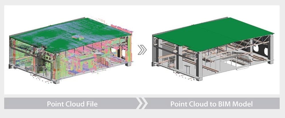
Converting a point cloud into a BIM model for building load calculations
Conclusion
Converting point clouds to BIM is an effective method for digitizing and documenting buildings and infrastructure. As technology develops, it is only a matter of time before the construction industry makes full use of point clouds. As a reminder, our speaker, Mikhail Chilikin, a BIM specialist and Autodesk Certified Instructor, will host a webinar on this topic. You can register here.
Source: https://www.bimcommunity.com/